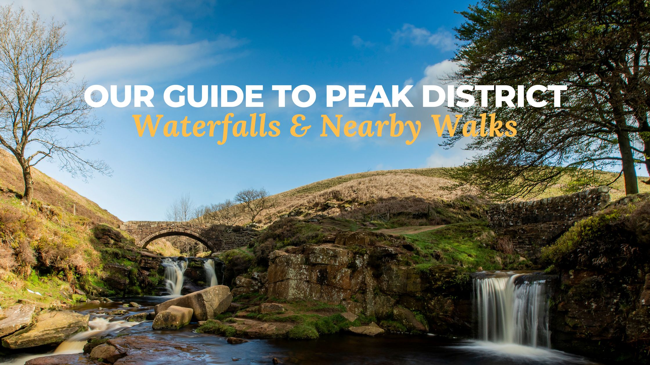
Our Guide to Peak District Waterfalls and Nearby Walks
Friday 24th January, 2025 by Host & Stay
The Peak District is renowned for its diverse landscapes and natural beauty, with striking mountains and sweeping hills, making it one of the best places in the UK for a staycation. A unique way to explore the area’s charm, and one of our favourite things to do when visiting, is to enjoy one of the many incredible Peak District waterfalls.
From the huge Kinder Downfall to the historic Lumsdale Falls, you’ll be spoilt for choice when it comes to amazing sights. Whether you’re planning a hike with a spectacular view or a road trip to see them all, we’ve put together our top 7 Peak District waterfalls to help you plan your visit.
If you’re looking for a place to stay during your trip, explore our collection of holiday lets in the Peak District to find the perfect place for you.
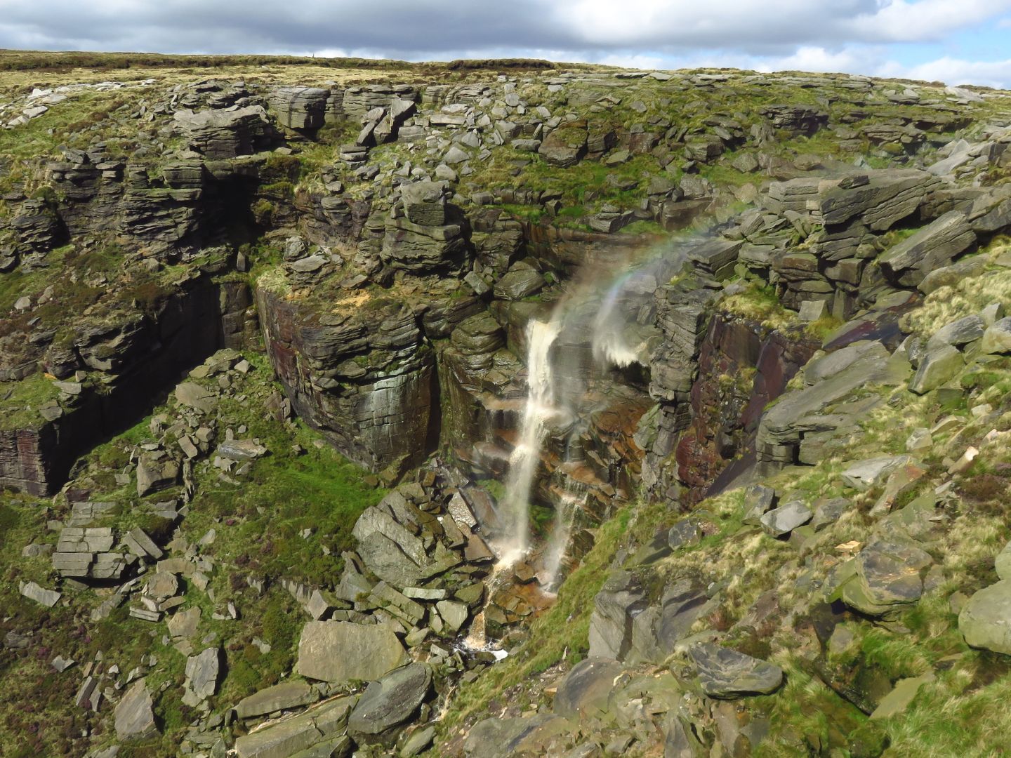
Kinder Downfall
At a glance:
- The tallest waterfall in the Peak District
- A beautiful location with other iconic nature sights nearby
- Time: Four to five hours
- Difficulty: Challenging
- Public transport: Edale Train Station
- Where to park: Bowden Bridge Car Park
Standing as the tallest Peak District waterfall, Kinder Downfall boasts a dramatic 30-metre drop. Located in the High Peak region, the waterfall is located on Kinder Scout and gets its name from the River Kind which travels down to the reservoir.
The surrounding moorland offers challenging yet rewarding hikes making it popular with walkers and climbers. A fantastic choice for a day out, the 2000ft peak of Kinder Scout is nearby along with Mermaid’s Pool (keep your eye out for the beautiful mermaid said to live there!) and Kinder Reservoir. If it’s sightseeing you’re looking for, Kinder Downfall offers some of the most incredible Peak District views too!
Useful information about Kinder Downfall:
Waterfall location
What3Words: ‘acute.unstated.parading’
Difficulty
The 8.7-mile circular walk from Bowden Bridge car park is considered a challenging hike as the terrain is rough and there is significant elevation gain with a few steep climbs.
Starting points
There are several routes you can take to reach Kinder Downfall. Our favourite is the 9-mile route which begins at Bowden Bridge car park and travels up to Kinder Reservoir, through the narrow winding path of William Clough, up to the edge of the Kinder Plateau before travelling onwards to Kinder Downfall.
Another option is to start from the village of Edale where there is a train station if you’re travelling by public transport. From here, it’s roughly a 4-5 hour walk which travels through Edale village and out onto the Pennine Way.
Public transport
If you’re travelling by public transport, you can visit Kinder Downfall from Edale Train Station (Station Road, Edale, Derbyshire, S33 7ZN).
Where to park
We recommend parking at Bowden Bridge Car Park (Kinder Road, Hayfield, SK22 2LJ). This small car park is located in an old quarry and was the original start point of the 1932 mass trespass on Kinder Scout. It cost £4.75 to park all day and you can pay with cash or on your phone using RingGo. If you have a Peak District National Park permit, you can park for free. There are toilet facilities at this car park.

Three Shires Head
At a glance:
- A series of small waterfalls and natural pools
- Serene location for wild swimming
- Time: Roughly two hours
- Difficulty: Moderately challenging
- Public transport: No public transport nearby
- Where to park: Clough House Car Park
As the name suggests, Three Shires Head is at the meeting point of three counties, Derbyshire, Cheshire, and Staffordshire, where the River Dane flows over a series of small waterfalls and beneath ancient packhorse bridges. Originally a place where horses could rest and have a drink of water, today it provides a serene setting to appreciate the natural beauty of the Peak District. Popular with wild swimmers, it’s a fantastic spot for a dip especially on warm days.
Useful information about Three Shires Head:
Waterfall location
What3Words: ‘clogging.busy.waitress’
Difficulty
The 5-mile walk from Clough House Car Park is considered moderately challenging due to the rocky and rough terrain.
Starting point
Three Shires Head is accessible via several walking routes, each offering scenic views of the surrounding countryside. Our favourite is the 5-mile walk from Clough House Car Park which has a gradual ascent and then leads down to the waterfall at the halfway point before heading to the village of Wildboarclough.
If you don’t fancy the 5-mile walk, you can park in one of the laybys along the A54 close to the Three Shires Head. It’s worth noting though that the spaces are limited and it’s often where people park especially during peak times of the year.
An alternative route is to start outside The New Inn pub in the village of Flash and travel up to Oliver Hill (at 513m above sea level!) before heading to Cheeks Hill, Axe Edge trig poin then onto Three Shires Head via Dry Stones Edge Road. This walk is longer than the above routes and is roughly 10 miles so if you fancy a long trail, this could be the one for you.
Public transport
Unfortunately, there is no public transport that travels close to Three Shires Head.
Where to park
You can park at Clough House Car Park (Clough House, Wildboarclough, SK11 0BD) for free. There are no toilet facilities here or drinking fountains but there are several picnic benches near the stream.
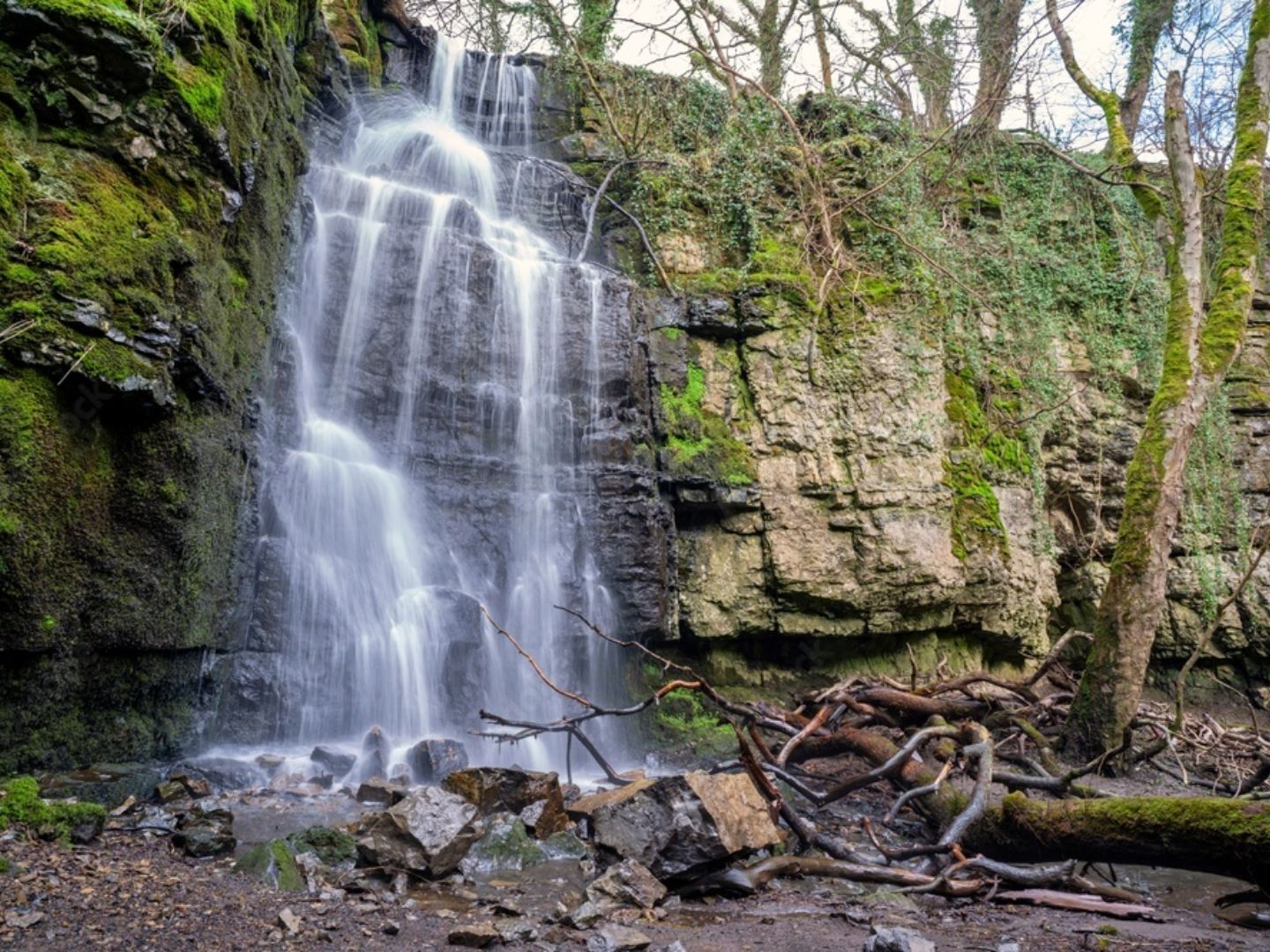
Lumsdale Falls
At a glance:
- Located within a historically rich area with 17th-century mill buildings
- Close to the popular town of Matlock
- Time: Roughly two hours
- Difficulty: Easy to moderate
- Public transport: X17 and 63 bus routes
- Where to park: Lumsdale Road opposite Highfields School
Nestled within the Lumsdale Valley near Matlock, Lumsdale Falls is a hidden gem that combines natural beauty with historical intrigue. The cascading waters flow through a wooded gorge, passing by the ruins of old mills, offering a glimpse into the area’s industrial past. The valley is part of a conservation area, and visitors are encouraged to respect the site’s heritage.
Useful information about Lumsdale Falls:
Waterfall location
What3Words: ‘hosts.blur.funds’
Difficulty
It’s worth noting that while the walk is considered to be easy to moderate, there is a steep hill towards the end. It also gets very muddy and slippy in the winter months so it’s definitely best wearing suitable footwear!
Starting point
The 2.1-mile circular walk starts on Lumsdale Road opposide Highfields School. The route takes you towards Riber Castle, Middle Pond, Lower Pond before reaching Lumsdale Falls.
Public Transport
Matlock train station is located in the town centre roughly 40 minutes on foot or 10 minutes by car from the start point. There are bus services which stop at the junction of the A623 and Lumsdale Road including the X17 which is the Matlock-Sheffield route and the 63 which is the Matlock-Chesterfield route.
Where to park
You can park for free along Lumsdale Road opposite Highfields School (DE4 5NA). If you’re planning your walk for a weekday when the school is open, it’s best to avoid drop off and pick up times as it does get busier.

Padley Gorge
At a glance:
- A family-friendly walk with pools for paddling
- Time: Roughly two hours
- Difficulty: Easy
- Public transport: Grindleford Railway Station
- Where to park: Longshaw Estate Car Park
Padley Gorge, situated near the village of Grindleford, features a series of gentle waterfalls along Burbage Brook. The area is enveloped by ancient woodland, providing a habitat for diverse wildlife and a peaceful retreat for walkers.
The easy-to-navigate trails make it a family-friendly destination so if you’re planning your stay in the Peak District with little ones, this could be the one for you! There are lots of picnic spots where little legs can rest and pools for paddling.
Useful information about Padley Gorge:
Waterfall location
What3Words: ‘linked.hiding.tens’
Difficulty
The walk to Padley Gorge is considered easy as it is generally decent terrain and has very little hills. It’s worth noting though that some patches can get very muddy and you will encounter rocks and tree roots.
Starting point
Our favourite walk to Padley Gorge begins at Longshaw Estate before heading downhill through the woodland, tracing along the river from above, to Grindleford Station then back up hill to the start point.
Public Transport
Padley Gorge is really well connected when it comes to public transport. Grindleford Railway Station (Station Road, Grindleford, S32 2HY) has a Northern train line running between Manchester and Sheffield. The station is a just a minutes’ walk from Padley Gorge so it’s super handy if you’re travelling via rail.
If you’re travelling via bus, the 271/272 bus service runs every hour throughout the day and stops at the Fox House Pub near Longshaw Hall making it ideal for the start point above.
Where to park
There are a number of options for parking in Grindleford. We prefer parking at Longshaw Estate Car Park (Grindleford, S11 7TZ) just because it’s easy and convenient. It’s £6 for up to 4 hours and £8 all day. If you’re paying with cash, it’s best to bring the correct change or alternatively, you can pay via your phone or by card in the Welcome Building. If you’re a National Trust member, you can park for free but remember to bring your membership card to scan at the machines as it’ll print off a ticket to display in your car.
Other parking options include free, on street parking along The Fox House Pub which is just down the road from the Longshaw Estate Car Park.
You can also park at Grindleford Train Station which is £3 all day and you need to use RingGo pay.

Middle Black Clough Waterfall
At a glance:
- A secluded waterfall with a 10-metre drop
- A short linear walk including rocks and water
- Time: Roughly one hour
- Difficulty: Challenging
- Public transport: No public transport
- Where to park: Layby parking on Woodhead Road (near Woodhead Reservoir)
For those seeking a more secluded adventure, Middle Black Clough Waterfall offers a rewarding experience. Located near the Woodhead Pass, reaching this waterfall involves a trek through rugged terrain, but visitors are rewarded with a stunning cascade nestled within a rocky enclave. The sense of isolation and untouched beauty makes it a favourite among avid hikers and nature lovers. Make sure to bring appropriate footwear as there is a water crossing (which can get deep after lots of rainfall).
Useful information about Middle Black Clough Waterfall:
Waterfall location
What3Words: ‘alpha.javelin.serious’
Difficulty
The walk to Middle Black Clough Waterfall is generally considered to be challenging. You will need to climb a hill at the start of the route and there is a rocky path which can be really slippery especially after heavy rain.
Start point
The start point for reaching Middle Black Clough Waterfall is the layby parking on Woodhead Road but there are a number of different routes which lead to the destination. Adventurers will like the two-mile walk which heads over the River Etherow, up a rocky path to the woods then up a clough until you reach the waterfall.
Public Transport
Unfortunately there is no public transport that travels close to Middle Black Clough Waterfall.
Parking
There are three small lay-bys just off the A628 on Woodhead Road near Woodhead Reservoir (SK13 1JE) where you can park for free on this walk.
Waterfall Swallet
At a glance:
- A secluded, hidden treasure
- The second highest Peak District waterfall
- Difficulty: Moderate
- Public transport: 6 and 65 bus routes
- Where to park: Hawkhill Road Car Park
A hidden treasure, Waterfall Swallet is a subterranean waterfall near the village Eyam and slightly off the beaten track. The second highest Peak District waterfall, the water here disappears into a limestone cave creating a magical sight. It’s worth noting that it’s best to visit Waterfall Swallet after decent rainfall otherwise there won’t be any water falling down the cliff wall.
Useful information about Waterfall Swallet:
Waterfall location
What3Words: ‘sprinting.litters.wipe’
Difficulty
Reaching Waterfall Swallet is moderate in difficulty. There are uneven rocks and potentially slippery surfaces so care is needed. The walk to this waterfall isn’t considered to be suitable for people with mobility issues.
Starting point
You can start your walk to Waterfall Swallet from anywhere in the village of Eyam, simply head along the footpaths to the Plague Stone to the north east. From there head up to Bole Hill before following the path just below Eyam Edge and the waterfall. Afterwards, you can head back to the village the same way or enjoy a longer circular route by following the footpaths east for wonderful countryside views.
If you’d prefer to just visit the waterfall without the full walk, the quickest route is from a small lay-by (coordinates: 53.2902792, -1.7032805) where there is space for a few cars to park fully off the road. From here, continue back down the road for about 70 metres and you’ll reach a small gate on the right. Head through the gate and down the stone steps which lead down to a wooden gorge and the waterfall.
It’s worth noting that it’s best to wear wellies all year round when visiting Waterfall Swallet as the bottom of the gorge is very boggy.
Public transport
The nearest train station to Eyam is Grindleford Railway Station (Station Road, Grindleford, S32 2HY) which is about four miles away.
There are a number of bus routes which travel through the village of Eyam. The number 6 route travels from Chesterfield to Litton and the 65 service travels between Sheffield and Buxton.
Parking
The nearest car park is Hawkhill Road Car Park (Hawkhill Road, Eyam, S32 5AD). This car park is open daily and is £5 for up to four hours. You can pay with cash or using RingGo on your phone.
As mentioned above, you could also try parking in the layby close to the waterfall if you’re hoping to take the short route. It’s worth noting there are only a couple of spaces here so parking is not guaranteed.

Derwent Dam
At a glance:
- An incredible man-made water cascade
- Used for training by the famous Dambusters during World War II
- Time: 1 – 2 hours
- Difficulty: Easy
- Public transport: 257 bus route
- Where to park: Fairholmes Visitor Centre Car Park
While not a natural waterfall, we couldn’t miss Derwant Dam from our list! This controlled overflow creates a spectacular man-made cascade, especially after periods of heavy rain. The dam, part of the Derwent Valley Reservoirs, is steeped in history having been used for training by the famous Dambusters during World War II. The surrounding area offers scenic walks and cycling routes, making it a popular spot for outdoor activities.
Useful information about Waterfall Swallet:
Waterfall location
What3Words: ‘sprinting.litters.wipe’
Difficulty
The 5-mile walk is considered easy as it has well-made paths and doesn’t feature any stiles or kissing gates.
Starting point
Starting at Fairholmes Visitor Centre (Bamford, Hope Valley, S33 0AQ), turn left onto the wide pavement which takes you back torwards the A57. From here, you’ll see Crook Hill, Win Hill, and Ashopton Viaduct as you travel along. After heading through a gate roughly 1.5 miles along the road, turn left to cross the bridge then take the track to the other side of the reservoir. After 1.5 miles, you’ll reach a small number of houses which are all that remain of Derwent village. Continue onwards on the left-hand travel downwards and you’ll reach Derwent Dam.
Public transport
The nearest train station to Derwent Dam is Bamford (off Saltergate Lane, Bamford, Derbyshire, S32 1EG) which is about four miles away.
The 257 bus route travels from Sheffield to Glossop with a stop at Derwent Dams, Fairholmes.
Parking
You can park in the Fairholmes Visitor Centre Car Park (Fairholmes, Derwent Lane, High Peak, S33 0AQ) which is open daily. There are roughly 100 spaces including disabled spaces. It is £3.50 for two hours or £6 for 24 hours, and you can pay with cash or card (but it’s worth taking cash in case the card option isn’t available). Plus there are toilets and a lovely little café on site too!
During peak season, the car park can become full so you could try parking in the lay-by parking on the road leading to the visitor centre. This parking is free but you just need to make sure there are no restrictions where you’ve parked.

Planning your visit
When exploring Peak District waterfalls, it’s essential to consider the following:
Footwear
Sturdy walking boots are recommended, as some trails can be uneven and slippery, especially after rainfall.
Weather:
The region’s weather can be unpredictable. It’s advisable to check forecasts and dress in layers to accommodate changing conditions.
Safety
Always stay on marked paths and be cautious near water edges. Some areas may have steep drops or slippery rocks.
Respect Nature
Ensure you leave no trace by taking litter home and avoiding disturbing wildlife.
Stay in the Peak District
At Host & Stay we offer a variety of accommodation options in the Peak District, from charming cottages to beautiful homes. Perfect for solo adventures, dog friendly stays, romantic retreats and family holidays, there is something for everyone here. From Matlock to Buxton, Bakewell to Ashbourne, an unforgettable stay awaits you in the Peak District.
EXPLORE OUR HOLIDAY LETS IN THE PEAK DISTRICT